





感謝大家支持,開設26週年WWW.PUNCHBROTHERSTOUR.THECHAINSMOKERSTOURDATES.COM 創業慶
WWW.PUNCHBROTHERSTOUR.THECHAINSMOKERSTOURDATES.COM
詳細請見這裡


 配送


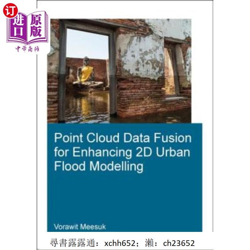
書 正版 Point Cloud Data Fusion for Enhancing 2D Urban Flood Mo的詳細資訊
書籍為正版書籍 ,部分絕版書籍,為舊書或者二手書籍,建議咨詢客服
1.書籍均為簡體正版書籍,大陸版社直接寄送。部分絕版書籍為二手二手書籍
2.貨物3天內安排寄送,到貨時間大概8~12天,有時間要求請及時聯繫。
3.圖書因物流運送且多為單冊包裝,偶有碰撞折損潮損,非無法閱讀均不可退貨,完美要求者請切勿下標。
4.大物件商品超過超區規格,需要下標宅配到付哦 。
5.可免費代尋書籍!店鋪每天上新歡迎關注!
6.收到商品有任何問題,歡迎咨詢,感謝~
開 本:20開
紙 張:輕型紙
包 裝:平裝-膠訂
是否套裝:否
國際標準書號ISBN:9781138306172
所屬分類:圖書>英文原版書>科學與技術 Science & Techology
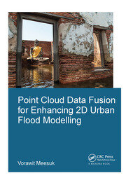
Point Cloud Data Fusion for Enhancing 2D Urban Flood Modelling
作者: Meesuk, Vorawit
出版社: CRC Press (2017年07月31日)
頁數: 314頁
語種: 英語
ISBN: 9781138306172
條形碼: 9781138306172
商品重量: 700.00g
商品尺寸: 23.88cm * 16.76cm * 1.78cm
編輯推薦
Modelling urban flood dynamics requires proper handling of a number of complex urban features. Although high-resolution topographic data can nowadays be obtained from aerial LiDAR surveys, such top-view LiDAR data still have difficulties to represent some key components of urban features. Incorrectly representing features like underpasses through buildings or apparent blockage of flow by sky trains may lead to misrepresentation of actual flood propagation, which could easily result in inadequate flood-protection measures. Hence proper handling of urban features plays an important role in enhancing urban flood modelling.
This research explores present-day capabilities of using computer-based environments to merge side-view Structure-from-Motion data acquisition with top-view LiDAR data to create a novel multi-source views (MSV) topographic representation for enhancing 2D model schematizations. A new MSV topographic data environment was explored for the city of Delft and compared with the conventional top-view LiDAR approach. Based on the experience gained, the effects of different topographic descriptions were explored for 2D urban flood models of (i) Kuala Lumpur, Malaysia for the 2003 flood event; and (ii) Ayutthaya, Thailand for the 2011 flood event.
It was observed that adopting the new MSV data as the basis for describing the urban topography, the numerical simulations provide a more realistic representation of complex urban flood dynamics, thus enhancing conventional approaches and revealing specific features like flood watermarks identification and helping to develop improved flood-protection measures.
Biographical Note
Vorawit Meesuk is a PhD candidate in hydroinformatics for urban flood modelling at UNESCO-IHE and TU-Delft, the Netherlands. He holds a background MSc degree in Remote Sensing and GIS technologies (2003) from Khon Kaen University, Thailand. His PhD research focuses on the topic of applying computer vision and photogrammetry techniques to create better topographical data by merging different sources and difference viewpoints to enhance 2D flood simulation for complex urban cities. Besides doing research, he organised the Ayutthaya workshop in a joint effort with ADB, UNESCO-BANGKOK, in 2014. He also guided MSc students and gave GIS and coupled 1D-2D modelling lectures at UNESCO-IHE. Currently, he works at (HAII/MOST) as a Head of Observation and Telemetry Section, whose responsibilities are to provide and maintain telemetry systems for monitoring weather conditions and water-level changes in over 700 stations in Thailand and neighbouring countries.
商品備註・物品狀況:全新・最新關注時間:2025-08-06






暢銷商品排行榜




查看此商品的人也看了以下商品
-
 我的商店庫存: 243含稅4655元
-
 我的商店庫存: 230含稅4323元
-
 我的商店庫存: 490含稅26543元
-
 我的商店庫存: 362含稅20928元
-
 我的商店庫存: 441含稅3773元
附近賣場的商品


顧客評論
推薦度 4.9分
目前有 101則評論。